

Global Navigation Satellite Systems (GNSS): The Invisible Backbone of Modern Technology
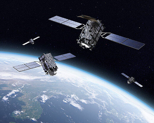
In the modern era, we rarely stop to think about how our smartphones know exactly where we are, or how autonomous drones navigate complex environments. The magic behind these capabilities is GNSS (Global Navigation Satellite Systems). While many people use the term “GPS” as a catch-all, GPS is actually just one part of a much larger, global infrastructure.
What is GNSS?
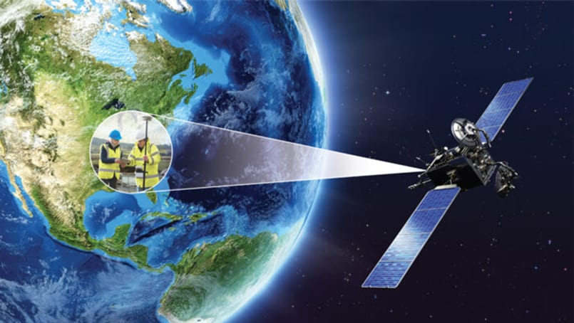
GNSS refers to a constellation of satellites providing signals from space that transmit positioning and timing data to GNSS receivers. The receivers then use this data to determine their location. By definition, GNSS provides global coverage, meaning a user can access the system from anywhere on the planet at any time.
The Major GNSS Constellations
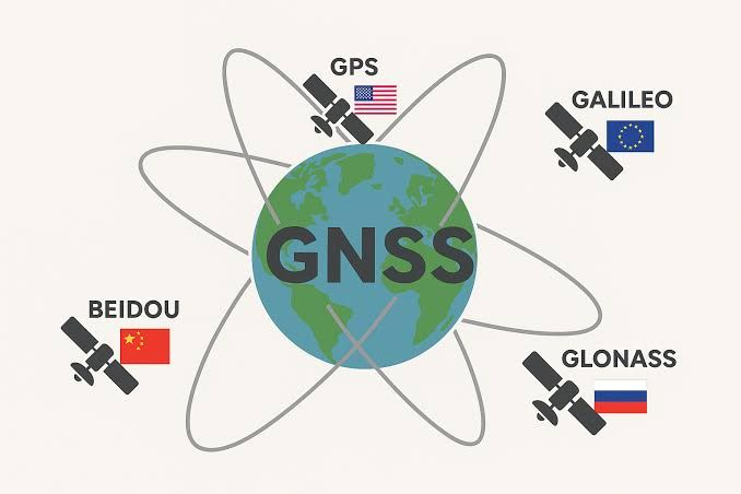
Currently, there are four major global systems:
1. GPS (Global Positioning System): Owned by the United States.
2. GLONASS: Owned by the Russian Federation.
3. Galileo: Owned by the European Union.
4. BeiDou: Owned by China.
How Does GNSS Work?
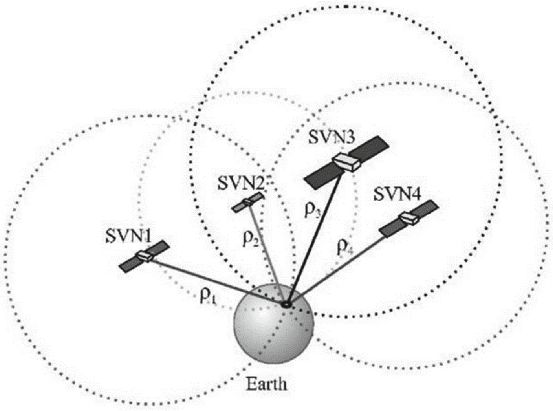
The fundamental principle behind GNSS is Trilateration.
To determine a 2D position (latitude and longitude), a receiver must lock onto signals from at least three satellites. However, to calculate a precise 3D position (including altitude), a minimum of four satellites is required.
1. Time is Key: Each satellite carries highly accurate atomic clocks. They broadcast the exact time the signal was sent.
2. Measuring Distance: The receiver calculates the time it took for the signal to arrive. Since the signal travels at the speed of light, the distance (d) can be calculated using the formula:
c (ti + ∆ti) − (τj + ∆tj)
where c is the speed of light and \Delta t is the time delay.
3. Positioning: By knowing the distance from multiple satellites, the receiver can “pinpoint” its own location on Earth’s surface.
Applications of GNSS
The impact of GNSS extends far beyond simple map navigation on our phones:
* Precision Agriculture: Tractors use GNSS to steer themselves with centimeter-level accuracy, reducing waste in seeds and fertilizers.
* Aviation and Maritime: Essential for safe routing, landing, and docking in all weather conditions.
* Telecommunications: GNSS satellites provide the ultra-precise timing needed to synchronize cellular networks and financial transactions.
* Geodesy and Mapping: Used by scientists to monitor the movement of tectonic plates and rising sea levels.
Future Trends: High-Precision Positioning
The future of GNSS lies in Accuracy. Standard GNSS (like the one in your phone) usually has an error margin of 3 to 10 meters. However, new technologies are pushing this boundary:
* RTK (Real-Time Kinematic): Uses a ground-based station to correct satellite errors, achieving centimeter-level accuracy.
* Multi-Band GNSS: Modern chips can now receive multiple frequencies from the same satellite, which helps eliminate errors caused by the Earth’s ionosphere.
Conclusion
GNSS is a silent utility that keeps the world moving. As we move toward a future of autonomous vehicles, smart cities, and advanced robotics, the reliability and precision of these satellite “clocks in the sky” will become more critical than ever.
References & Further Reading
1. European Space Agency (ESA): What is Galileo GNSS?
2. Federal Aviation Administration (FAA): Satellite Navigation – GPS/GNSS
3. GPS.gov: Official U.S. Government information on GPS and related topics
4. NovAtel: An Introduction to GNSS